
The Dolomites have a reputation as a place for serious boots and long ascents, and that reputation is earned on the high passes. It is not the whole picture. Three areas in particular are published as low-effort walking country: the shore of Lago di Braies, the wide plateau of the Alpe di Siusi, and the meadows above Vigo di Fassa. Each offers a flat or nearly-flat route measured in minutes rather than hours, with benches, huts and viewpoints placed along the way. This guide covers those three, and only those: the graded half-day hikes are a separate subject with their own dedicated guide.
For travellers aged 50 to 70 who want scenery without strain, the pattern is consistent. You ride a lift or park close to the start, walk on broad gravel or firm lakeside paths, and stop when you choose. The Dolomites' official hiking pages describe high plateaus such as the Alpe di Siusi as having "mostly flat, well-maintained trails" that suit families and less experienced hikers alike, and note that numerous cable cars remove the climbing by carrying walkers up to flatter terrain (Dolomites official hiking overview). That combination, a lift up and a level path at the top, is the single most useful fact in this article.
Which walks in the Dolomites are genuinely flat?
Three routes are documented as flat or nearly flat. The Lago di Braies shore loop runs about 3.5 to 3.6 km with roughly 30 to 39 m of climb. The Alpe di Siusi publishes short level trails including a barrier-free walk of about 21 minutes and a 30-minute geology trail. From Vigo di Fassa, a cable car reaches Ciampedìe, where an easy walk to Rifugio Gardeccia takes about an hour.
Those three sit in different valleys and suit different trips. Lago di Braies is a lake circuit with a wooden jetty and boat hire. The Alpe di Siusi is open meadow with huts. Vigo di Fassa is a lift-served balcony above a Ladin town. What they share is a published low-effort rating and a surface you can walk in comfortable shoes rather than mountaineering boots.
Is the Lago di Braies loop easy for older walkers?
Yes, with one qualification. The official circuit is described as an easy hike that can be walked clockwise or anticlockwise from Hotel Lago di Braies along a wide lakeside path. It is about 3.5 to 3.6 km, takes roughly 60 to 90 minutes at a relaxed pace, and is not uniformly flat: the eastern side is narrower and has steps.
The lake, known as the "Pearl of the Dolomites" and among the most photographed alpine lakes in Italy, sits in the Valle di Braies in South Tyrol. The official route description, published by the Braies/Prags holiday region, sets the start at Hotel Lago di Braies and follows a wide lakeside path (Braies/Prags official lake page). The first stretch is suitable for pushchairs. The second part has steps near the rock face, though it is still described as easy to manage.
Where you walk matters more here than at the other two sites. The northern and western shores are the flattest and most accessible sections, and the west shore is described as broad and stroller-friendly. The eastern side is wilder, more shaded, and in one source has some gentle elevation or stairs. If you want a short, level outing rather than a full circuit, the western shore alone delivers the classic view of the lake with the Croda del Becco behind it.
 AI-edited
Distances and surfaces at Lago di Braies
| Detail | Figure | Condition |
|---|---|---|
| Circuit length | About 3.5 to 3.6 km | Full loop, both shores |
| Climb | About 30 to 39 m | Full loop |
| Time at relaxed pace | 60 to 90 minutes | Without long stops |
| Easiest section | Northern and western shores | Wide, largely flat |
| Harder section | Eastern shore | Narrower, some steps |
| Surface | Gravel and firm path | Can be muddy on the left side after rain |
Benches and picnic areas are documented along the path, with one regional page referring to numerous benches. The southern shore has a small meadow used as a rest spot. The walk passes the wooden jetty and the boat-hire point, and the lakeside hotel and bistro sit at the start.
How do you reach Lago di Braies in summer?
Plan around the valley access rules, not the lake. The municipality of Braies announced a summer 2025 traffic regulation limiting access to the Valle di Braies from 10 July to 10 September 2025, between 09:30 and 16:00. During that window the valley can be reached by public transport, on foot, by bike, or with an online reservation or valid transit permit.
The official Braies/Prags regulation cited sets the 2026 traffic-control period from 1 July to 15 September, with daytime access controlled between 09:00 and 16:00. The rule applies to the valley, not just the lake itself. Paid parking is documented, and in high season a pedestrian fee applies.
Sources say the lake is reachable by bus during the regulated period, with advance booking or prepayment required for some services in peak season. One report notes that the combined ticket includes parking, transit permission, shuttle transport where needed, and a restaurant or shop voucher. The exact terms change year to year, so confirm the current arrangement with the Braies municipality before you travel (Braies municipal traffic regulation).
When is Lago di Braies quiet?
Early morning and the shoulder months. Arriving before 7 a.m. meant only about a dozen quiet visitors in one account, while the same lake became crowded later in the morning. The sourced material recommends June to early July and September to October as the best visit window.
Crowding is the most consistent complaint in guest feedback about the lake area. Reviews warn that quiet walking becomes hard once visitor traffic arrives and recommend very early or late visits. One September 2026 trip report describes the lake as packed, with side branches too crowded to enjoy properly. Another suggests spending a night locally so the lake can be enjoyed peacefully at dawn.
"The views are simply stunning, and it's easy to understand why so many people dream of visiting. A practical tip for anyone arriving by car: come early. Parking spaces tend to fill up by mid-morning, especially during peak season." (Google, June 2026)
July and August are the busiest months. May, October and November can bring limited lift operations and some accommodation closures. The lake itself is open year-round, but walking and access conditions vary by season, and the lake freezes from late November to April, when most facilities close.
Is the Alpe di Siusi good for gentle meadow walking?
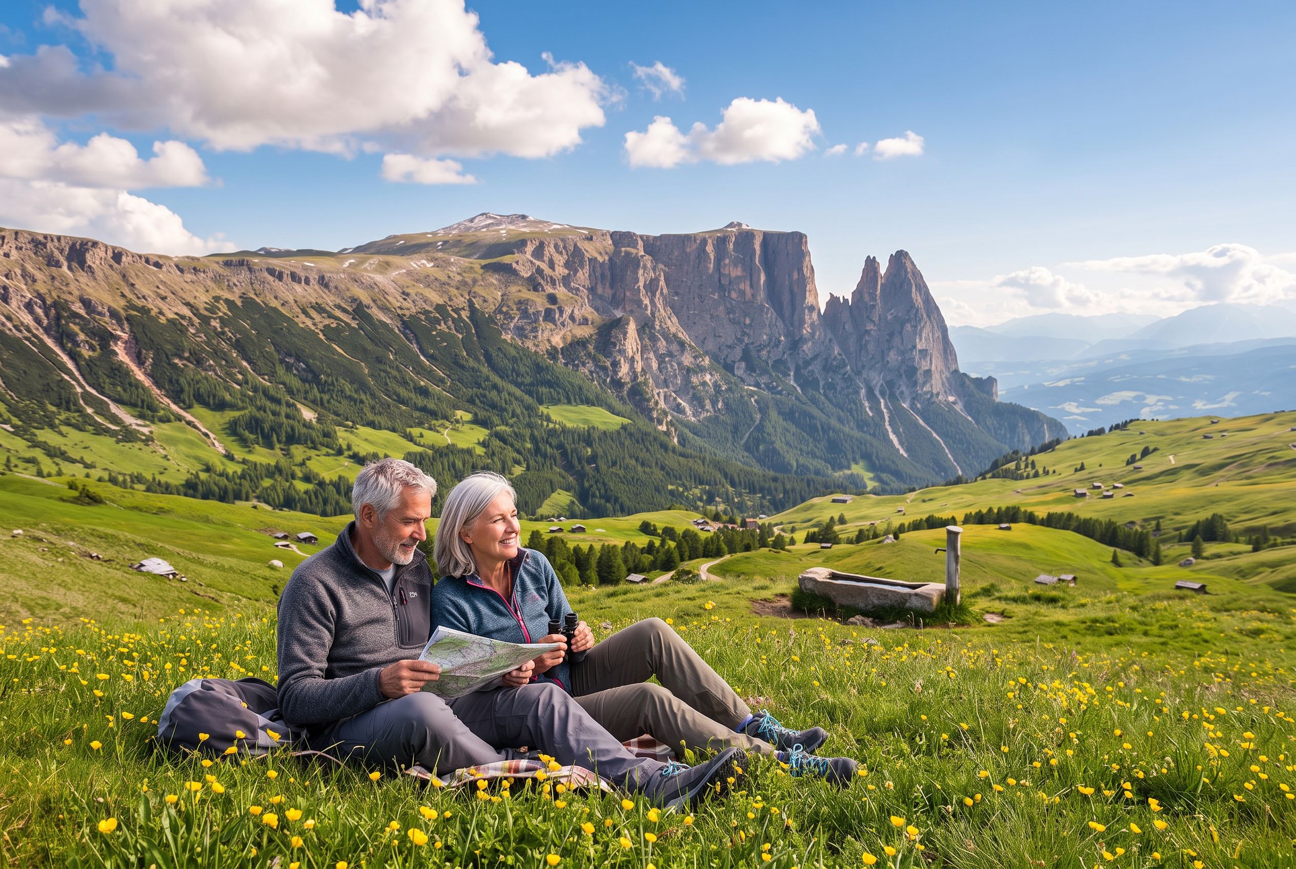
It is the strongest match in the Dolomites for flat meadow walking. The Alpe di Siusi, described by its own tourism office as the largest mountain plateau in Europe, publishes mostly flat, well-maintained trails. Documented easy options include a barrier-free walk of about 21 minutes and the Geomile Seis trail of about 30 minutes.
The plateau sits above Siusi and Ortisei in South Tyrol. Its own excursion pages describe it as the starting point for pleasant walks and long hikes, with over 300 km of trails allowing the whole family to spend leisure time in sport and recreation. A separate page for the wider Alpe di Siusi and Sciliar area cites over 400 km of hiking trails. The Dolomites' official hiking overview states that on high plateaus such as the Alpe di Siusi you find mostly flat, well-maintained trails suitable for families and less experienced hikers.
The main routes are gravel or broad tracks rather than technical mountain paths, with benches placed at scenic stopping points. Pushchairs manage the main gravel arteries in dry weather, while grass can be harder going. A recorded guide describes the classic Compatsch circuit as two easy hours through pastureland, and another page notes short themed walks and panorama loops above Compatsch.
Short documented walks on the Alpe di Siusi
| Route | Duration | Notes |
|---|---|---|
| Barrier-free walk on the Seiser Alm | About 21 minutes | Published by Südtirol |
| Geomile Seis trail | About 30 minutes | Published by Südtirol |
| Hans and Paula Steger Nature Trail | About 20 to 30 minutes | Starts at St Francis church, Compatsch, path 30; bus option for the return |
| Compatsch circuit | About 2 hours | Described as easy, through pastureland |
| Panoramic hiking tour on the Alpe di Siusi | 15.8 km, 4 hours 40 minutes | Longer option; resting points on route |
Guest feedback on the plateau is consistent on two points. Reviews describe predominantly easy, well-marked trails suited to families, children, and older or less fit walkers, with panoramic Dolomite views throughout. Numerous mountain huts and restaurants serve local dishes such as speck, dumplings and apple strudel, and restrooms are maintained and located across the area. The plateau holds a Google rating of 4.8 out of 5 from 4,734 reviews, as of September 2026.
How do you get up to the Alpe di Siusi, and what does it cost?
By cable car from Siusi or Ortisei, by bus, or by car outside restricted hours. The operator lists summer 2026 operations from 22 May to 2 November 2026, with longer daily hours from 7 June to 6 September 2026. A senior fare for those born in 1960 or earlier is €18 one-way and €26 return.
Reduced-rate tickets are sold only at the cable car's own ticket offices, not online. Wheelchair users, blind passengers and people with 100% disability travel free, while some other passengers with disability travel at the senior fare level. These are the operator's published summer 2026 terms, and fares change by season.
Car access is the part that catches people out. The road up is closed to cars from 09:00 to 17:00 during the season. Holders of an official European Disability Card may drive up to Seiser Alm and Compatsch at any time, but prior registration and an access permit via the municipal portal are required. Guest reviews report the restriction as 9am to 5pm in one account and 8am to 6pm in another, so confirm the current hours locally. Parking near the ski station fills by mid-morning in peak season, and the drive up is described as steep and winding.
For a wider look at how lifts, buses and passes fit together across the region, see our guide to getting around the Dolomites by cable car and bus.
What is the walking like above Vigo di Fassa?
From June to September a cable car takes visitors from Vigo di Fassa to Ciampedìe, where Visit Trentino recommends a very easy walk to Rifugio Gardeccia taking approximately one hour. The same page says the walk is suitable for everyone, including children.
This is the third of the three low-effort areas, and the least documented in the material gathered for this article. Visit Trentino publishes the Ciampedìe to Gardeccia route as the easy option from the lift, with lunch and views of the Rosengarten/Catinaccio group at the hut. Opening times should be checked and booking made in advance. A second option from the same start point, the walk to Rifugio Roda de Vael, takes about three and a half hours round trip and sits closer to the half-day category.
Visit Trentino advises checking that the cable cars are actually running before choosing one of these trips, which is normally the case from June to September or October. If they are not, the alternative is one of the many walks through the villages. Vigo di Fassa itself is well supplied for a rest day: the Museo Ladin de Fascia holds ethnographical collections built over 20 years of research by the Ladin Cultural Institute, and the Pieve di San Giovanni has a bell tower standing 67 metres tall. A short walk leads to the little Church of Santa Giuliana and the Austro-Hungarian cemetery, passing through a cool larch wood. QC Terme Dolomiti, described by Visit Trentino as one of the most renowned wellness centres in Trentino, is a short distance from the village (Visit Trentino Vigo di Fassa itinerary).
Where will you find benches and rest stops?
Benches are documented at Lago di Braies, where regional material refers to numerous benches along the path and a small meadow on the southern shore serves as a rest area. On the Alpe di Siusi, benches are placed at scenic stopping points along the main gravel routes, and huts provide tables, food and restrooms.
For Vigo di Fassa, the material does not document specific bench locations on the Ciampedìe meadow walk. The rest stop named in the source is Rifugio Gardeccia, where lunch and views of the Rosengarten group can be had. Treat the hut as the bench.
Practical rest planning follows the same pattern at all three sites. Huts and lakeside bistros serve food and drink in season, and restrooms are maintained on the Alpe di Siusi. Guest feedback on the lake tours notes that some food outlets can be closed and that bringing snacks and water is advisable. Warm clothing is recommended even in summer, as conditions can turn to rain or snow during the day.
What is documented about accessibility, and what is not?
The UNESCO Dolomites Foundation documents 36 accessible trails and 13 panoramic viewpoints reachable by fully accessible lift systems across the nine mountain systems, with technical sheets in Italian, German and English carrying maps, GPS coordinates and stopping points. Beyond that programme, accessibility details for these three specific walks are only partly documented.
At Lago di Braies, sources state that the lakeshore area near the hotel and parking is partly accessible, with the flatter, wider sections on the north and west shores being the best option. The full circuit is not wheelchair-complete. One guide notes that the shoreline paths can be gravelly, uneven or sloped, which makes the lake area less accessible than it appears in photographs.
On the Alpe di Siusi, the operator's tariff page states that wheelchair users, blind passengers and people with 100% disability travel free on the cable car, and the plateau is promoted for stroller-friendly paths. For Vigo di Fassa, the material does not document reduced-mobility access details for the Ciampedìe meadow walk. The nearest pharmacy, on-site medical help and formal assistance services are not documented for any of the three areas in the material reviewed. Travellers who need those details should confirm them with the local tourist office before travelling.
For a broader look at lift-served viewpoints and level ground across the region, see our article on seeing the Dolomites with little walking.
How should you plan the day, and what about safety?
Walk in June, September or early July for open lifts and thinner crowds, carry water and a layer, and treat the altitude with respect. The single European emergency number 112 reaches mountain rescue across the Dolomites. In the Veneto Dolomites, the health emergency number is 118, and one source says the operations centre is active 24/7.
Altitude can affect travellers even on routes described as easy. A September 2026 trip report notes that one traveller had altitude problems and had to skip a higher hike. The Alpe di Siusi and Ciampedìe walks both start above 1,500 m, so build in a slower first hour.
Footwear matters more than the grade suggests. The official Alpe di Siusi excursion page advises hiking boots, warm clothing, sun and rain protection, food in the backpack and a hiking map. Even on the flat meadow routes, that is sound advice. Walking poles are repeatedly implied as useful on popular easy trails.
No universal senior fare applies across the Dolomites. Reductions are set valley by valley and product by product, so check each lift's own tariff page. The Geological Museum of the Dolomites states an over-65 reduced ticket of €4, and the DoloMythos Museum states a senior rate for ages 60 and over of €12 against €14 for adults. Lift tickets and museum fares are indicative and vary by season and booking channel.
For accommodation with step-free access and quiet rooms, our review of Cristallo in Cortina d'Ampezzo and our review of Rosa Alpina in San Cassiano both cover what older guests should ask before booking.
What should travellers aged 50 to 70 expect on the ground?
Expect broad gravel and firm lakeside paths rather than paved promenades, benches at intervals, and a serviced hut or bistro within reach on each route. Expect the flattest walking on the western shore at Braies and around Compatsch on the Alpe di Siusi. Expect crowds at Braies unless you arrive early.
The Dolomites are not flat in the ordinary sense. One forum contributor put it plainly: nothing is easy in the Dolomites for an inactive flat-lander, even while listing genuinely manageable routes. The three walks in this guide are the exception that proves the rule, and they work because a lift, a car park or a hotel puts you at the start of level ground.
Guest feedback from travellers in their 70s describes the Alpe di Siusi as very easy, with trails numbered and signposted, and an easy walk down the road from the top cable-car station to the hotel. Reviews of the plateau call the scenery stunning and recommend spending one or two hours on the panoramic trail. That is the shape of a good day here: a short lift ride, an hour or two of level walking, a hut lunch, and an unhurried return.
For the graded half-day routes, including the Tre Cime and Seceda outings, see our separate guide; they are a different kind of day and deserve their own planning.


