
Located in the heart of Tyrol, the Zillertal valley offers a rare combination for travellers aged 50 to 70: genuine alpine scenery that does not demand a steep climb to enjoy it. The valley floor is broad, the river path is flat, and several cable cars lift you to panoramic viewpoints without breaking a sweat. This guide focuses entirely on the gentle routes—the riverside promenades, the level reservoir trails, and the top-station circuits where the only effort is deciding where to sit and admire the view.
Where are the best flat walks in the Zillertal?
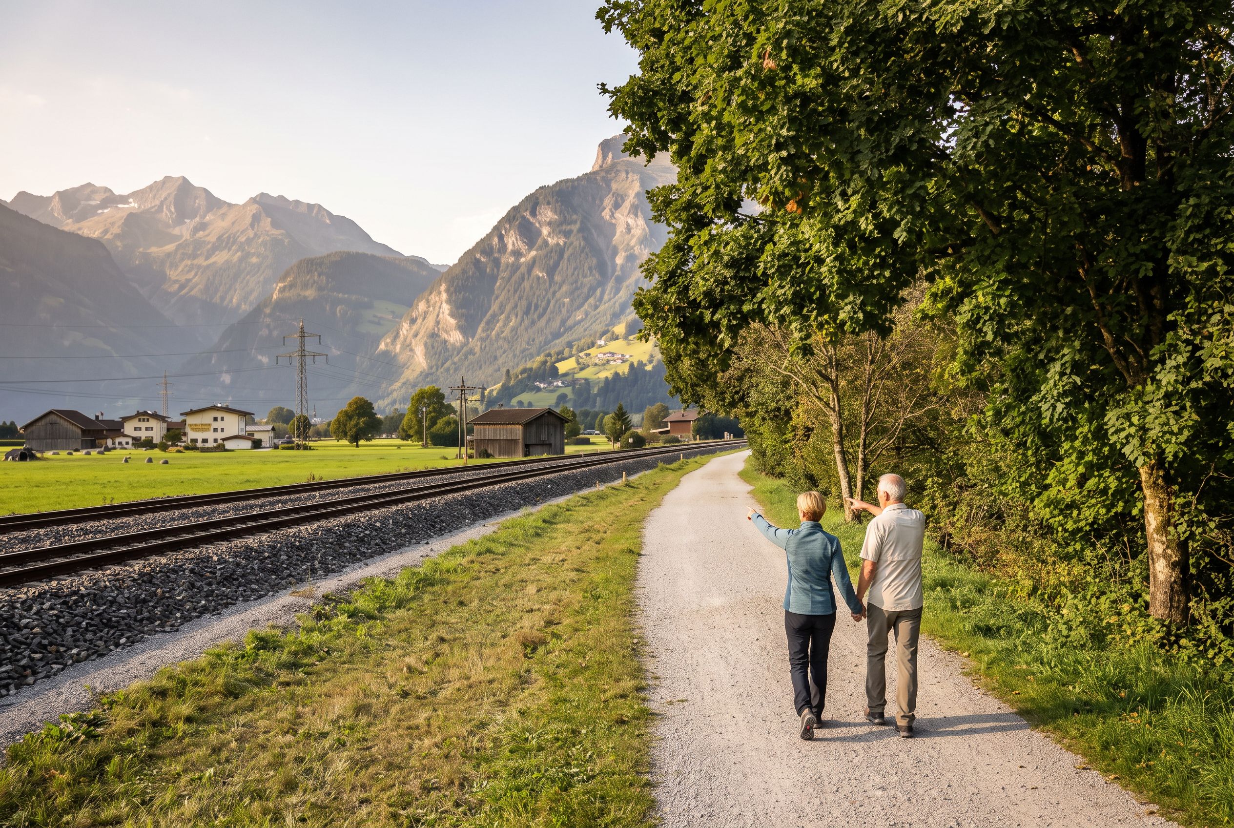
The Zilleruferweg, a fully wheelchair-accessible riverside path running between Zell am Ziller and Mayrhofen, is the valley's premier flat walk. It follows the Ziller River on a paved, level surface for roughly 10 kilometres, with benches every few hundred metres and no gradient to speak of.
This is the walk you return to again and again. The surface is smooth tarmac or fine gravel, suitable for rollators and walking frames. You can start from either end—the path connects directly to the town centres—and walk as far as you feel like, then catch the Zillertalbahn back. The railway runs parallel to the trail, and as of July 2026, trains operate roughly every hour with barrier-free boarding at all main stations. The sound of the river accompanies you the whole way, and the views open up across hay meadows to the steep valley walls above.
For a shorter option, the section between Mayrhofen and Hippach is particularly pleasant. The tourism board's Easy Trail Mayrhofen–Hippach covers 24.5 kilometres in total, but you can take just the 4-kilometre stretch from the Mayrhofen church to the Hippach village square. It is signposted throughout, has no steep inclines, and remains walkable in all weather conditions according to the official route description on Mayrhofen's tourism site.
Which reservoir walks offer level terrain and big views?
The Schlegeis Stausee reservoir area provides a flat, paved lakeside path of about 3 kilometres that is explicitly suitable for wheelchair users and walkers seeking a view without climbing. The Stillup reservoir offers a similar but shorter gravel trail with benches overlooking the water.
The Schlegeis approach is the more dramatic of the two. You drive or take the bus up the Schlegeis alpine road—open from 28 May to 26 October 2026, weather permitting—and park at the dam. From there, a level path runs along the eastern shore of the turquoise reservoir. The surface is compacted gravel, firm underfoot, and the gradient is barely perceptible. About halfway along, you reach a wooden viewing platform with a bench that faces directly toward the Olperer peak and the famous Insta-Brücke suspension bridge. The bridge itself is part of a more demanding hike covered in a separate guide, but the view from the lakeside bench is equally stunning and requires no extra effort.
The Stillup reservoir, located in the Stilluptal side valley, is smaller and quieter. The path here is a 2-kilometre loop, mostly flat, with a surface of packed earth and occasional wooden boardwalks. The Stilluptal road opens from 14 May 2026. This walk feels more intimate—the water is closer, the forest reaches down to the shore, and the benches are spaced at regular intervals. It is an excellent choice for a post-lunch stroll when you want solitude rather than spectacle.
| Reservoir | Path length | Surface | Road open | Benches |
|---|---|---|---|---|
| Schlegeis Stausee | 3 km (one way) | Compacted gravel | 28 May – 26 Oct 2026 | Every 300 m |
| Stillup reservoir | 2 km (loop) | Packed earth, boardwalk | 14 May 2026 | Every 200 m |
Which cable-car top stations offer easy walking circuits?
The Ahornbahn in Mayrhofen reaches a high plateau with the Genießer-Rundweg, a 1.5-kilometre circular path suitable for prams and wheelchairs. The Gerlossteinbahn near Hainzenberg provides a shorter top-station terrace with panoramic valley views and a level 500-metre promenade.
The Ahornbahn is the standout choice for a view-without-climbing day. The cable car departs from Mayrhofen's town centre and rises 1,500 metres in about 10 minutes. At the top, the Genießer-Rundweg (Connoisseur's Circuit) is a paved loop that stays completely flat. It passes through alpine meadows with wildflowers in summer, and the benches are positioned to face the main ridge of the Zillertal Alps. The entire circuit takes about 30 minutes at a gentle pace. There is a mountain restaurant at the top station with a sunny terrace, and the walk is sheltered enough that you can do it even on cooler days.
Guests at the Neuhaus Zillertal Resort consistently praise the Ahornbahn as a highlight of their stay. As of July 2026, the resort holds a Google rating of 4.3 out of 5 from over 1,400 reviews, with many guests noting the convenience of being a two-minute walk from the Mayrhofen station. One traveller from the United Kingdom mentioned that the Ahornbahn "made the Alps accessible without any hiking anxiety."
The Gerlossteinbahn, located near Hainzenberg, is a smaller operation but equally rewarding. The top station has a wide terrace with benches and a short, level promenade that runs along the ridge for about 500 metres. The view here is directly down the Zillertal valley, giving you a sense of the valley's full length. On clear days, you can see the peaks of the Kitzbühel Alps to the east. The Gerlossteinbahn has a TripAdvisor rating of 4.9 out of 5 from 643 reviews as of July 2026, with guests frequently describing it as "a hidden gem for non-hikers."
What about the valley-floor walking in the main towns?
The main towns of Zell am Ziller, Mayrhofen, and Fügen all have flat, paved promenades along the river or through their centres. These are ideal for a morning stroll before the cable cars open or an evening walk after dinner.
Zell am Ziller's riverside promenade runs for about 1.5 kilometres along the Ziller, with wide pavements and benches overlooking the water. The town's main square is pedestrianised and flat, with several cafes where you can sit and watch the Zillertalbahn trains pass. Mayrhofen's centre is similarly walkable, with a pedestrian zone that connects directly to the Ahornbahn station. Fügen has a shorter but well-maintained riverside path that leads to the Erlebnistherme Zillertal thermal baths—a pleasant destination for a gentle walk followed by a soak.
Recent guest feedback from the Neuhaus Zillertal Resort highlights the convenience of these town promenades. One traveller from Canada noted that "the flat paths along the river meant we could walk every day without worrying about our knees." The resort's location in Mayrhofen puts you within a five-minute walk of the main promenade and the Ahornbahn, making it a practical base for a low-exertion trip.
How accessible are these walks for travellers with limited mobility?
The Zillertal's valley-floor routes and cable-car top stations are among the most accessible in the Austrian Alps, with barrier-free access at the Zilleruferweg, the Ahornbahn, and the Schlegeis reservoir path. However, older village sidewalks in smaller settlements can be uneven, so stick to the main promenades and signed level routes.
The Zillertalbahn railway is a key accessibility asset. As of July 2026, the trains offer low-floor boarding with a lifting platform for wheelchair users, and the main stations at Jenbach, Zell am Ziller, and Mayrhofen have level access. This means you can combine a flat walk with a train return without navigating stairs. The valley's bus network is also step-free on major routes, though some smaller village stops may have kerbs without ramps.
For the reservoir walks, the Schlegeis path is the most accessible, with a firm gravel surface and no steps. The Stillup path has a few short sections of boardwalk that are slightly uneven, but it remains manageable for most walkers. Both paths have benches at regular intervals, and the Schlegeis path has a dedicated wheelchair-accessible viewing platform.
"The Zillertal is a valley that rewards the slow traveller. The flat walks along the river and the easy cable-car rides give you the alpine experience without the alpine effort. It is a place where you can spend a week and never feel you have missed the mountains." — David K., traveller from Australia
Where are the best benches and rest stops along these walks?
The Zilleruferweg has benches approximately every 300 metres, many positioned under willow trees with direct river views. The Schlegeis reservoir path has six benches along its 3-kilometre length, including one at the viewing platform facing the Olperer peak.
On the Zilleruferweg, the benches between Mayrhofen and Hippach are particularly well placed. The third bench from the Mayrhofen end, about 1 kilometre out, sits at a bend in the river where the water runs over a small weir—a good spot for watching dippers and grey wagtails. On the Ahornbahn's Genießer-Rundweg, the benches are set back from the path slightly, each facing a different section of the alpine panorama. The fourth bench, about halfway around the circuit, has a direct view of the 3,500-metre Hochfeiler peak.
For a rest stop with refreshments, the mountain restaurant at the Ahornbahn top station has a sun terrace with deck chairs. The Schlegeis reservoir has a small kiosk at the dam end, open during the summer season, serving coffee and simple snacks. In Mayrhofen, the riverside cafes on the main promenade offer shaded seating and are popular with local walkers.
When is the best time of year for these easy walks?
The ideal season for flat valley walks and cable-car viewpoints is June through September, when all lifts and alpine roads are fully operational. The valley-floor trails remain walkable from April through October, but the cable cars and reservoir roads have specific opening windows.
According to the Zillertal tourism board, the summer cable car season typically runs from mid-May to early October, with exact dates varying by lift. The Ahornbahn operates from late May to early October, while the Gerlossteinbahn runs from early June to late September. The alpine roads to Schlegeis, Stillup, and Zillergrund open in late May and close in late October, weather permitting. The Zillertaler Höhenstraße, a scenic road with several viewpoints, opens from end of May 2026.
For the most reliable access, plan your visit between mid-June and mid-September. July and August are the busiest months, but the valley-floor paths are wide enough to feel uncrowded. September offers quieter conditions and the added bonus of autumn colours along the river. The Easy Trail Mayrhofen–Hippach is explicitly described as accessible year-round, but winter walking requires caution on snow-covered sections.
| Attraction | Opens | Closes | Notes |
|---|---|---|---|
| Ahornbahn (Mayrhofen) | Late May 2026 | Early Oct 2026 | Step-free boarding |
| Schlegeis alpine road | 28 May 2026 | 26 Oct 2026 | Weather-dependent |
| Stilluptal road | 14 May 2026 | 4 Oct 2026 | Gravel surface |
| Zillertaler Höhenstraße | End May 2026 | Late Oct 2026 | Scenic viewpoints |
How do I get between these walks without a car?
The Zillertalbahn railway connects all major valley towns from Jenbach to Mayrhofen, with hourly services and barrier-free boarding. Buses run to the reservoir roads and cable-car bases, with the Melchboden and Zirmstadl routes operating until early October.
For a car-free trip, base yourself in Mayrhofen. The town has the highest concentration of flat walks, cable cars, and train connections. From Mayrhofen, you can take the Zillertalbahn south to Zell am Ziller for the Zilleruferweg, or north to Jenbach for connections to Innsbruck. The bus to Schlegeis reservoir departs from Mayrhofen station several times daily during summer, with a journey time of about 45 minutes. The Stillup reservoir is reachable by a local bus from Mayrhofen that runs hourly.
For more detailed transport logistics, including train frequencies and bus routes, see our dedicated guide on getting around the Zillertal without a car. If you prefer a structured approach, the small-group and guided tours guide covers options that include transport to the reservoir walks and cable-car stations.
What should I pack for a day of easy walking?
Bring sturdy walking shoes with good grip—even on flat paths, gravel and occasional damp sections require stable footwear. A light waterproof jacket, sunscreen, and at least one litre of water per person are essential, as mountain sun and dehydration can catch you unawares.
Forum discussions among travellers aged 50 and over consistently emphasise the importance of a small rucksack with a rain jacket and water. One contributor on a travel forum noted that "water at high stations can be expensive, so carry your own." A walking stick can be helpful on the gravel sections of the reservoir paths, though the valley-floor trails are smooth enough to manage without. For the cable-car top stations, bring a warm layer—the temperature at 2,000 metres can be 10 degrees cooler than the valley floor.
If you plan to combine your walks with a visit to the thermal baths, pack swimwear and a towel. The Erlebnistherme Zillertal in Fügen is a popular post-walk destination, with indoor and outdoor pools and a sauna area. For a broader perspective on what the valley offers beyond walking, see our guide to day trips worth making from the Zillertal.


