
The Zillertal Alps offer some of the most rewarding half-day walking in the Eastern Alps, especially for fit travellers aged 50 to 70 who want modest ascent, cable-car support, and mountain-hut stops. These routes are designed for keen walkers who value scenery over summit-bagging.
This guide focuses on four specific half-day routes: sections of the Berliner Höhenweg that work as day walks, the Zillertal Alps nature park trails from Ginzling, the Schlegeis reservoir circuit, and glacier-view paths. Each is graded for difficulty, ascent, and time, with practical advice on when to attempt them. We exclude flat valley strolls and via ferrata—those have their own dedicated guides.
Why is the Zillertal a strong choice for active over-50s?
The Zillertal combines flat valley bases, accessible cable cars, and a wide mix of easy-to-hard hiking options, making it one of Austria's most practical Alpine destinations for fit older walkers. The valley has 1,400 km of signposted trails across three altitude levels, with ten summer cable cars providing lift-assisted access to higher terrain.
The region has invested heavily in barrier-free tourism. The Zillertalbahn railway is low-floor and wheelchair-accessible, and major lifts such as the Ahornbahn, Spieljochbahn, and the Hintertux Glacier gondola offer ground-level entry. For active over-50s, this means you can start a walk at 2,000 metres without a long, steep approach. The valley's main bases—Mayrhofen, Zell am Ziller, and Fügen—are well connected by public transport, though Mayrhofen is hillier than the flatter centres of Zell am Ziller and Fügen.
Can you walk sections of the Berliner Höhenweg as a half-day hike?
Yes, but only specific sections work as half-day outings for fit over-50s. The full Berliner Höhenweg is a demanding multi-day high-alpine trek of about 85 km with 5,800–6,600 metres of elevation gain, typically completed in seven days. It is not a casual half-day walk and is suitable only for experienced alpine hikers with no fear of heights.
However, the first and last sections of the route can be walked as standalone day trips. The section from Finkenberg to the Berliner Hütte (2,042 m) is a manageable out-and-back of about 3–4 hours with 450 metres of ascent. The trail is well marked but includes some exposed sections and requires surefootedness. The final section from the Ahornbahn top station down to Mayrhofen is gentler, with only 200 metres of descent on a broad path through alpine meadows.
As of July 2026, the Kasseler Hütte winter room on the Berliner Höhenweg is closed for renovation and extension work, so if you plan an overnight stay, check the current status. The best hiking window for these sections is mid-July to mid-September, when snow has cleared from the higher passes.
"I walked the section from Finkenberg to the Berliner Hütte as a day trip. The views were extraordinary, but the trail is steeper than it looks on the map. I was glad I had walking poles and good boots." — David K., traveller from Canada
What are the best nature park trails from Ginzling?
The Zillertal Alps Nature Park around Ginzling offers some of the most accessible half-day walks in the region. The Ginzling–Schlegeis valley floor trail is a gentle 6 km route along the Zemmbach river, with only 150 metres of ascent, suitable for fit walkers who want a relaxed morning out.
For a more rewarding option, the circular trail from Ginzling to the Breitlahner Alm (1,500 m) takes about 2.5 hours with 350 metres of ascent. The path climbs through mixed forest and opens onto alpine pastures with views of the surrounding peaks. The Breitlahner Alm serves hearty Tyrolean food and is open from June to September.
The nature park also offers guided walks led by park rangers, which are particularly useful for learning about the region's flora and geology. These walks are typically 3–4 hours and cost around €15 per person. For independent walkers, the trails are well marked with standard Austrian signage showing estimated walking times in hours, not minutes.
Is the Schlegeis reservoir circuit suitable for over-50s?
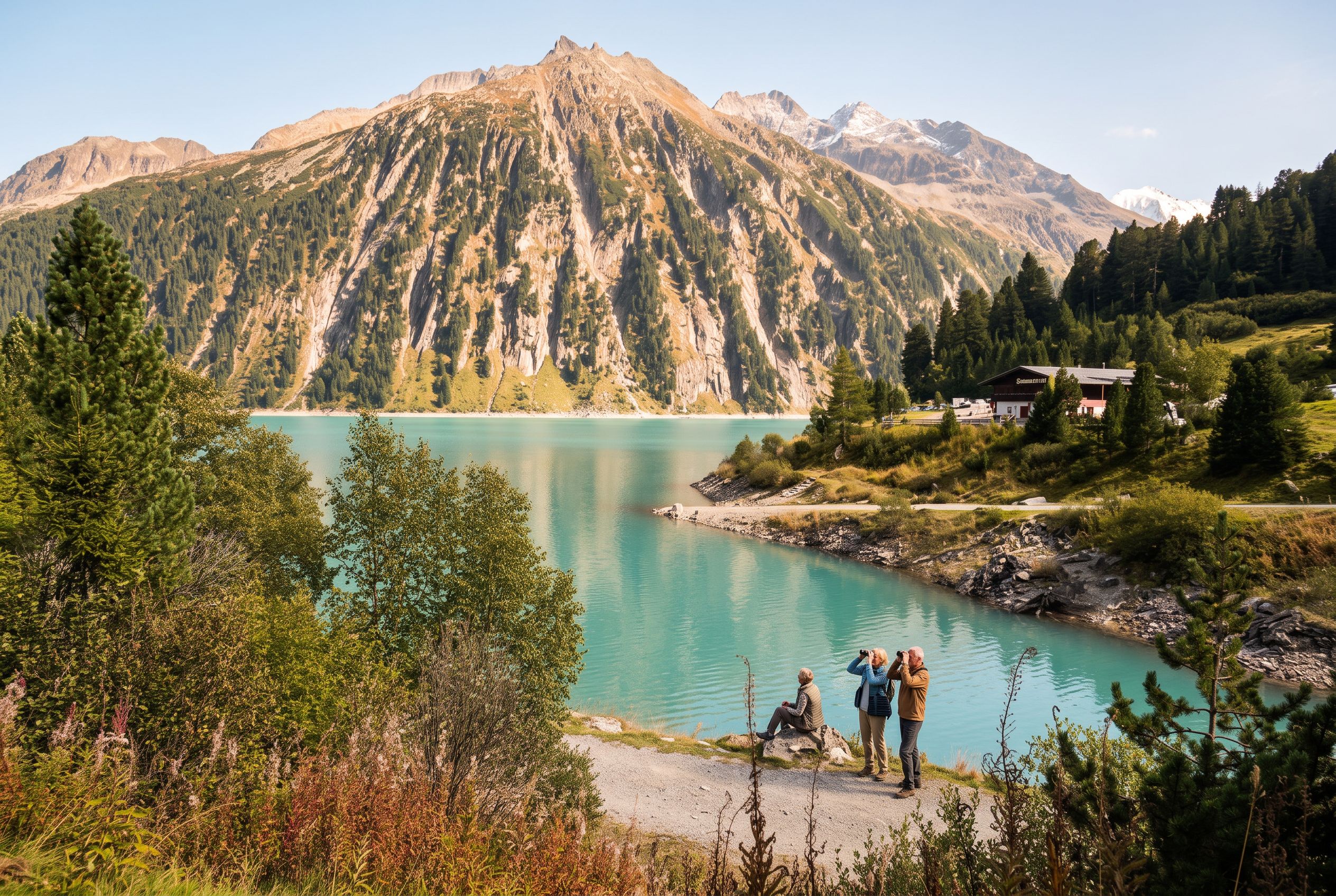
Yes, the Schlegeis reservoir circuit is one of the best half-day walks for active over-50s. The flat, paved path along the dam and lakeshore is about 4 km and takes 1–1.5 hours at a leisurely pace. The reservoir sits at 1,782 metres, with dramatic views of the surrounding glacier-carved peaks.
The Schlegeis Alpine Road is open daily from 14 May to 26 October 2026, according to VERBUND, the operator. The road is toll-based—expect to pay around €15 per car. Alternatively, bus line 4102 runs from Mayrhofen train station to Schlegeis in season, with a mountaineers' bus on Fridays, Saturdays, Sundays, and public holidays from early July to early September.
Recent guests consistently praise the reservoir's scenery and well-maintained paths. As of July 2026, the Schlegeis Reservoir holds a 4.1/5 rating on Tripadvisor from 158 reviews, with many older travellers noting the flat walking trails and paved paths suitable for relaxed strolls. The dam walk offers several scenic lookout points with views of the emerald water and surrounding mountains.
For a longer outing, you can continue from the reservoir up to the Olpererhütte (2,389 m). This adds 350 metres of ascent over 2 km of steep, rocky trail. The Olpererhütte is famous for its Instagram-worthy suspension bridge, but the climb is challenging and requires good fitness and surefootedness. Most over-50 walkers find the lakeside circuit sufficient for a satisfying half-day.
| Method | Details | Cost | Season |
|---|---|---|---|
| Car (Schlegeis Alpine Road) | Toll road from Ginzling, 13 km | ~€15 per car | 14 May – 26 Oct 2026 |
| Bus line 4102 | From Mayrhofen station to Schlegeis | ~€8 one way | June – September |
| Mountaineers' bus | Fridays, Saturdays, Sundays, public holidays | ~€10 return | Early July – early Sept |
| Walking from Ginzling | 6 km valley trail, 150 m ascent | Free | May – October |
What glacier-view paths work for half-day walks?
The Hintertux Glacier area offers accessible glacier-view walks without the need for technical climbing. From the top station of the Hintertux Glacier gondola (3,250 m), a flat, paved walkway leads to the Nature's Ice Palace entrance, with panoramic views of the glacier and surrounding peaks.
For a longer walk, the Tuxer Fernerhaus circuit is a 5 km loop with 200 metres of ascent, taking about 2 hours. The path crosses moraine terrain and offers close-up views of the glacier tongue. The Tuxer Fernerhaus itself is a comfortable mountain hut serving food and drinks, open from June to September.
Another option is the walk from the Gefrorene Wand (Frozen Wall) cable car station to the Spannagel Cave entrance. This is a 3 km round trip with minimal ascent, suitable for walkers who want a geological focus. The cave is a natural marble formation and can be visited on guided tours.
As of July 2026, the Hintertux Glacier gondola operates year-round, making this one of the few glacier-view walks accessible even in shoulder seasons. However, afternoon weather can be unpredictable at altitude, so start early and carry warm layers even in summer.
How are these routes graded for difficulty?
Each route in this guide is graded using a simple three-tier system: Easy (flat or gentle gradient, paved or well-maintained paths), Moderate (some ascent, uneven terrain, requires good fitness), and Challenging (significant ascent, exposed sections, requires surefootedness and alpine experience).
Here is how the specific routes grade:
- Schlegeis reservoir circuit: Easy. 4 km, flat paved path, 1–1.5 hours. Suitable for all fitness levels.
- Ginzling–Breitlahner Alm loop: Moderate. 6 km, 350 m ascent, 2.5–3 hours. Requires good fitness but no technical difficulty.
- Berliner Höhenweg section (Finkenberg–Berliner Hütte): Challenging. 8 km return, 450 m ascent, 3–4 hours. Exposed sections, requires surefootedness.
- Hintertux glacier-view walk: Easy. 2 km flat paved path, 45 minutes. Suitable for all fitness levels.
- Tuxer Fernerhaus circuit: Moderate. 5 km, 200 m ascent, 2 hours. Moraine terrain, requires good footwear.
For fit over-50s, the Easy and Moderate grades are the sweet spot. The Challenging grade is only recommended for experienced alpine walkers who are comfortable with exposure and have good balance.
Which mountain huts make good lunch stops?
The Zillertal's mountain huts are a highlight of any half-day walk. They serve hearty Tyrolean food, cold beer, and coffee, and many have sun terraces with panoramic views. The best huts for over-50 walkers are those with easy access and reliable opening hours.
At Schlegeis, the Schlegeis Stausee restaurant is open daily during the road's operating season and serves fresh fish from the reservoir, along with traditional schnitzel and dumplings. Recent guests note the food is good but the restaurant can be busy at peak times.
On the Ginzling–Breitlahner Alm loop, the Breitlahner Alm is a working alpine dairy that produces its own cheese. It is open from June to September, weather permitting. The Alm serves simple, authentic food—think Speckknödel (bacon dumplings) and Kaiserschmarrn (shredded pancake).
At the Berliner Hütte, the hut is open from mid-June to late September. It offers overnight accommodation and a full menu. The hut is popular, so book ahead if you plan to stay overnight.
"The Breitlahner Alm was the highlight of our walk. The cheese platter with fresh bread and a cold beer was exactly what we needed after the climb. The views from the terrace are stunning." — Sarah M., traveller from the UK
When is the best time to attempt these walks?
The main hiking season in the Zillertal runs from late May to late October, but the best window for these half-day walks is June to September. The Schlegeis Alpine Road opens in mid-May, but higher trails may still have snow patches until late June.
For the Berliner Höhenweg sections, the safest window is mid-July to mid-September, when snow has cleared from the higher passes and the huts are fully open. The Ginzling nature park trails are accessible from May to October, but the Breitlahner Alm only opens in June.
As of July 2026, the Schlegeis Alpine Road is open daily from 14 May to 26 October, with earlier opening hours in July and August (7:00 am–8:00 pm) and shorter hours in shoulder months (8:00 am–6:00 pm). The Hintertux Glacier gondola operates year-round, making glacier-view walks possible even in winter.
Weather in the Alps can change rapidly. Even in July, afternoon thunderstorms are common. Start all walks by 8:00 am to avoid the worst of the weather. Check the Zillertal tourism hiking page for live trail conditions before heading out.
What practical tips should over-50 walkers know?
Plan your walk around lift operating hours, carry cash for hut purchases, and always check the weather forecast before setting out. The Zillertal's cable cars and buses are reliable, but they have seasonal schedules that change year to year.
Here are the key practical points:
- Lift passes: The Zillertal Summer Card offers discounted cable-car access. A 3-day card costs around €45 and includes the Ahornbahn, Penkenbahn, and Spieljochbahn.
- Cash: Many mountain huts do not accept credit cards. Carry at least €30 per person for food and drinks.
- Footwear: Good walking boots with ankle support are essential for Moderate and Challenging routes. Walking poles help on descents.
- Sun protection: At altitude, UV levels are high. Wear sunscreen, a hat, and sunglasses even on cloudy days.
- Water: Carry at least 1 litre per person. Refill points are available at huts but not on the trail.
- Mobile coverage: Most of the valley has good mobile reception, but higher trails may have patchy coverage. Download offline maps before you go.
For those who prefer guided outings, the Small-Group and Guided Tours of the Zillertal: A Senior’s Practical Guide covers organised walks tailored to over-50s.
Can you combine these walks with other attractions?
Yes, the Zillertal's compact geography makes it easy to combine a half-day walk with other activities. The Schlegeis reservoir walk pairs well with a visit to the Zillertal Alps Nature Park visitor centre in Ginzling, which has exhibits on local wildlife and geology.
The Hintertux glacier-view walk can be combined with a visit to the Nature's Ice Palace, an ice cave accessible via a flat paved walkway from the top station. The ice palace is open year-round and costs around €15 per person.
For a cultural add-on, the Almabtrieb cattle descent takes place from mid-September to mid-October, with decorated cows, folk music, and village celebrations. This is a living tradition that adds colour to any walking trip.
If you have a full day, consider the Day Trips Worth Making from the Zillertal: Innsbruck, Achensee, Krimml & Wattens guide for ideas on extending your stay.
How accessible are these walks for different mobility levels?
The Schlegeis reservoir circuit and Hintertux glacier-view walk are fully accessible for walkers with limited mobility, with flat paved paths and step-free access. The Ginzling nature park trails are suitable for fit walkers but include uneven terrain. The Berliner Höhenweg sections are not accessible for anyone with mobility challenges.
The Zillertal is one of Austria's leading regions for barrier-free tourism. The Ahornbahn, Spieljochbahn, and Hintertux Glacier gondola all offer ground-level entry. The Zilleruferweg between Zell am Ziller and Mayrhofen is a fully wheelchair-accessible riverside path, though that is covered in the Easy Valley Walks and the Best Views in the Zillertal guide.
For walkers who want altitude without the climb, the Riding the Cable Cars: The Zillertal's Peaks Without the Climb guide covers scenic lift rides that require no walking at all.
| Route | Mobility Level | Paved Paths | Step-Free Access |
|---|---|---|---|
| Schlegeis reservoir circuit | Easy (wheelchair possible) | Yes | Yes |
| Hintertux glacier-view walk | Easy (wheelchair possible) | Yes | Yes |
| Ginzling–Breitlahner Alm | Moderate | No | No |
| Berliner Höhenweg section | Challenging | No | No |
The Zillertal offers some of the most rewarding half-day walking in the Alps for fit travellers aged 50–70. With cable-car support, reliable hut stops, and well-maintained trails, these routes deliver Alpine scenery without the strain of full-day expeditions. Plan your walks around the June–September window, start early, and carry the essentials. The views from Schlegeis and the glacier paths will stay with you long after you return home.


