
Three routes carry the weight of this guide: the Adolf Munkel Trail below the Odle, the lower loop at Tre Cime di Lavaredo, and the ridge paths above Seceda. Each is a half-day outing with modest ascent, each starts with a lift or a short drive, and each suits a walker who is fit, sure-footed and past the age of wanting a full day on scree. The Dolomites are a UNESCO World Heritage Site, and the UNESCO Dolomites Foundation coordinates 36 accessible routes and 13 accessible viewpoints across the mountain systems, though its technical sheets cover a wider network than the three walks described here.
What follows is planning information rather than a route card for every variant. Distances, ascents and timings are attributed to the operator, authority or publication that states them.
Which half-day hikes in the Dolomites suit active over-50s?
The Adolf Munkel Trail, the Tre Cime lower loop and the Seceda ridge paths are the three best-documented half-day options for fit walkers aged 50-70. Each runs 4 to 13 km with 350 to 450 m of ascent, is graded easy to moderate, and can be completed in three to five hours including stops.
The Adolf Munkel Trail runs beneath the Odle and Geisler peaks in Val di Funes. One operator listing gives it as a 9 km (5.6 mile) loop with roughly 400 m (1,310 feet) of ascent, graded easy to moderate on the CAI scale at T/E, starting from the Zannes (Zans) parking area (dolomitesactivetours.com). A separate Val Gardena route entry for a section of the same named trail, from Resciesa to Malga Zannes, is marked difficult at 11.9 km with 280 m of ascent and 705 m of descent. The trail is best treated as a family of variants rather than one fixed route.
Tre Cime di Lavaredo is the signature walk around the three peaks. One listing gives the loop from Rifugio Auronzo as 9.5 km, three hours, 400 m of height difference and a maximum altitude of 2,454 m. A different operator listing puts the same circuit at roughly 13 km (8.1 miles) with about 450 m (1,475 feet) of ascent, graded moderate at CAI E. Travel sources describe the main circuit as moderate and typically three to five hours.
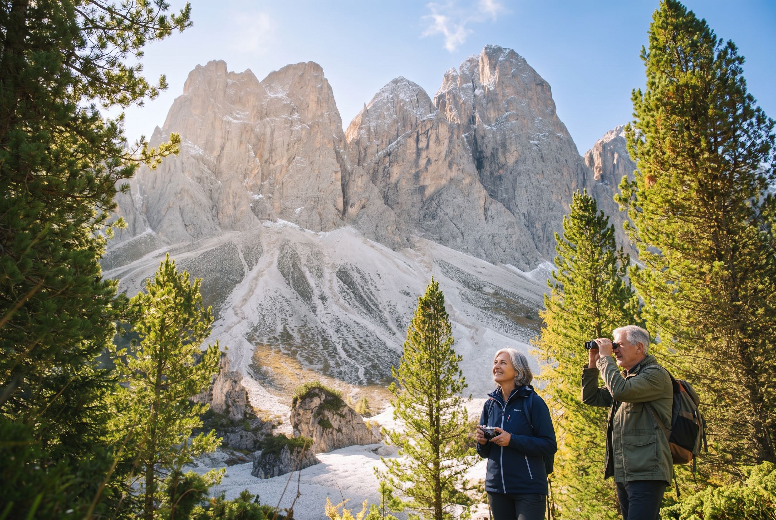 AI-edited
What is the Adolf Munkel Trail like on the ground?
The Adolf Munkel Trail is a long but non-technical walk beneath the Odle, with gentle ups and downs across the loop. The main challenge is distance rather than difficulty. Parts are steep at the start and the surface can be rocky or rooty, so boots and poles earn their place.
One operator describes the route as offering the best effort-to-scenery ratio on its list of day hikes, calling it a low-stress walk with gentle climbing (dolomitesactivetours.com). A forum report from a walker who completed it in about 1.5 hours adds that it is a little less rigorous than the alternatives but still requires good boots and possibly hiking poles. A Reddit contributor described the standard 9 km path as a straightforward hike with views throughout.
The trailhead sits at the Zannes car park in Val di Funes. Parking there is generally reserved for people with online bookings unless you arrive very early or very late, so reserve ahead in high season. Walkers without a car can take the public bus from Bressanone or Chiusa into Val di Funes and then the local shuttle to Zannes; if the shuttle is not running, the final segment from Ranui adds extra uphill mileage.
How hard is the Tre Cime lower loop?
The Tre Cime loop is graded moderate, not easy. It is mostly straightforward underfoot but includes stony paths and short steep ascents, and it is not a flat stroll. Budget three to five hours, and treat the first half from Rifugio Auronzo to Forcella Lavaredo as the gentler section.
The loop splits naturally: an easier first half from Auronzo Hut to Lavaredo Hut and Forcella Lavaredo, then a return via Locatelli Hut and Malga dei Pastori. One travel source calls it one of the most iconic hikes in the Dolomites, while another describes it as family friendly and doable for most people with a moderate difficulty rating (theworldtravelguy.com). A further source claims it delivers more scenery per hour than any other moderate route in the range.
Route-specific official figures for a lower loop variant are not documented in the material behind this guide, so its exact difficulty, ascent, timings, opening rules and fares should not be treated as fixed facts. What is documented is the access. The toll road costs €40 and requires an online reservation with your licence plate from late May through October. One source advises reserving two to three days ahead; another suggests a week in high season. The toll road and the rifugi operate only from mid-June to mid-October, and shoulder season brings sudden snow risks.
Are the Seceda ridge paths worth a half day?
Yes, if you ride the lift up. The Seceda ridge section itself is around 1 km and takes about an hour including scenic stops, so it works as a half-day base rather than a full-day outing. The cable car removes roughly 1,200 m of climbing that the walk up from Ortisei would otherwise demand.
The ridge line runs from the Seceda cable car mountain station to the summit cross at 2,519 m and continues toward the Panascharte saddle. A paid turnstile of €5.00 is now in place for the descent east from the summit cross on trail no. 6 toward Panascharte, and the saddle itself is not accessible. An alternative continuation toward the lower-lying Mastlé Alm uses trail no. 1.
The operator publishes two easy walks from the ridge area: Seceda to Pieralongia to Odles at 5.8 km and 1.5 hours, and Seceda to Trojer to Fermeda at 4.2 km and one hour. The Fermeda route continues gently downhill to the valley station of the Fermeda chairlift, and the Seceda premium ticket lets walkers ride that chairlift uphill. For a car-free day, ride the Seceda cable car up from Ortisei, traverse the ridgeline and descend to the Col Raiser lift. Drivers should note that Ortisei parking is very limited.
If you want the ridge without the climb, the mechanics of lifts and buses across the range are covered in our guide to getting around the Dolomites by cable car and bus.
When should over-50s attempt these hikes?
Late June to early October is the strongest window for Tre Cime, late May to late October for the Adolf Munkel Trail, and early June to mid-October for Seceda. Late June and September offer the best balance of open trails and thinner crowds, according to one 2026 Seceda guide.
Hut openings on the Tre Cime circuit run June to September. The Adolf Munkel Trail's listed best period is June to October, with one source describing it as walkable from June well into golden October. The Seceda operator says the area is already accessible from mid-May under normal conditions and stays suitable for panoramic autumn hikes until early to mid-November, and advises checking snow and weather conditions in spring and late autumn.
Outside the Seceda hiking season, and in the winter period from early December to early April, the Seceda lifts are closed and access is on foot only. The Tre Cime access road is seasonal and opens when snow clears, roughly late May to late October.
| Route | Documented season | Access start |
|---|---|---|
| Adolf Munkel Trail | Late May to late October | Zannes (Zans) car park, Val di Funes |
| Tre Cime loop | Late June to early October | Rifugio Auronzo via toll road or bus |
| Seceda ridge | Early June to mid-October | Ortisei-Seceda cable car station |
What do the lifts cost, and how do you book them?
Seceda is the only one of the three with published lift pricing in the material behind this guide. A 2026 guide reports €74 round trip and €49 one way for the full Seceda lift journey, with the lift season running 22 May to 2 November 2026. The Fermeda chairlift is priced separately at €41 round trip and €28 one way, operating 20 June to 20 September 2026, 09:30 to 16:30.
Seceda ascents in summer 2026 are organised into fixed 30-minute time slots, with advance online booking available and waiting times possible if you buy at the ticket office. The Val Gardena notice states that the altoadigemobilità Pass gives a 35% discount on the Seceda ascent when shown with ID, and that the Dolomiti Super Summer Card is not valid for the Seceda lifts or the Fermeda chairlift. A general early booking discount of 5% is documented for Seceda tickets.
No senior-specific or over-65 fare for the Adolf Munkel Trail, the Tre Cime loop or the Seceda lifts is documented in the material behind this guide, so treat that as not documented rather than assumed. Reductions across the Dolomites are not universal and are often set valley by valley or product by product. The clearest published senior fare belongs to a different lift entirely: the Seiser Alm cable car charges €18 one way and €26 return in summer 2026 for people born in 1960 or earlier, and reduced tickets can only be bought at the ticket offices with the person present and valid ID.
For the wider picture of passes, buses and lift logistics, see our guide to cable cars, buses and the ski pass.
How do you reach the trailheads without a car?
All three routes have documented car-free options. Buses serve Val di Funes and the Tre Cime trailhead, and the Seceda cable car starts in the centre of Ortisei. The exact seasonal timetables are not fully documented in the material behind this guide, so confirm times locally before you travel.
For the Adolf Munkel Trail, take the public bus from Bressanone or Chiusa into Val di Funes, then the local shuttle to Zannes. For Tre Cime, take the public bus from Dobbiaco, or the seasonal DolomitiBus service via Misurina if you are coming from Cortina d'Ampezzo. Bus line 444 serves the trailhead. One source notes the operator's shuttle returns from 30 May, but the full seasonal timetable is not documented.
Seceda is the simplest of the three without a car: the cable car station sits in Ortisei, and the ridge walk begins at the mountain station. Ortisei parking is very limited, which makes the lift the easier choice for drivers too.
How difficult are these walks, and what should you watch for?
All three sit in the easy-to-moderate band for a fit walker, with the Adolf Munkel Trail the gentlest underfoot and Tre Cime the most exposed to cold and crowds. None is technically difficult. Good boots, poles and layers are the practical essentials.
One forum report warns that the Tre Cime loop will add at least four to five hours to your journey, excluding the drive up and down, and that it is not that easy. The same report flags August traffic as a concern for Tre Cime access. A Reddit contributor described Tre Cime as extremely chilly on their visit, with people wearing socks on their hands, and said it felt more like winter than summer. Layers matter even in high season.
The Seceda operator's tips and rules of conduct page asks walkers to stay on marked trails, avoid alpine meadows, not climb fences and check local weather before setting out, especially if rain or thunderstorms are forecast. The same page notes that meadows are private property managed by local farmers, so leaving the trail is against the stated conduct rules for the area.
Emergency numbers documented in the material behind this guide are 112 for mountain rescue across the Dolomites and 118 for health emergencies in the Veneto Dolomites. No source documents the nearest pharmacy or medical help specifically for these three routes, and no source documents formal safety staffing, trail patrols or rescue points on them. The UNESCO Dolomites Foundation publishes technical sheets in English, German and Italian to help walkers judge suitability, but the material behind this guide does not provide a trail-by-trail list for these routes.
How long should you allow, and when should you start?
Allow three to four hours for the Adolf Munkel Trail including hut stops, three to five hours for the Tre Cime loop, and about an hour on the Seceda ridge itself, plus lift time. Start early. A Reddit contributor advises arriving at the Zannes car park before 8 AM.
One operator recommends a late-morning start on the Adolf Munkel Trail so that you reach Geisler Alm for lunch. For Seceda, one operator suggests catching the first lift at 8:30 AM or heading up after 3:00 PM, noting the last lift down is at 6 PM. Those times hold for the Seceda lift season, which a 2026 guide gives as 22 May to 2 November, daily 08:30 to 18:00.
A forum report makes a useful point for planning: a short walk can still become a full half-day or more once access, parking and viewpoints are included. Treat the published walking times as the walking only, and add the lift queues, the drive and the stops.
If a half-day on steeper ground is not what you want, the magazine covers gentler alternatives in its guide to easy meadow and lakeside walks in the Dolomites, which has its own dedicated article.
What else should over-50s know before setting out?
Book the Tre Cime toll road and the Zannes car park in advance, carry cash for the €5.00 Seceda turnstile, and check the weather the morning you go. Where the material behind this guide is silent on a detail, confirm it locally rather than assuming.
Recent closures elsewhere in the range underline why marked-trail discipline matters. After multiple rockfalls on the slopes of Cima Falkner, authorities evacuated hikers and closed several trails and climbing routes in the Brenta Dolomites; routes 315 and 316 later reopened while 305 and 331 remained closed. In the San Vito di Cadore area, the CAI 241 trail from Dogana Vecchia to Cengia del Banco and trail 242 on the Ferrata Berti were closed from 18 June 2025 after landslides near Croda Marcora, with penalties for ignoring the ban. Reported rescue statistics said callouts rose 20% year on year.
No recent press item in the material behind this guide documents a closure or reopening of the Adolf Munkel Trail or the Tre Cime loop themselves. No source documents specific closing days or maintenance closures for those two routes either, beyond the seasonal lift and hut windows already described.
For a comfortable base between walks, our review of the Cristallo resort in Cortina d'Ampezzo covers one option in the heart of the range. If you would rather keep the walking to a minimum, the guide to seeing the Dolomites with little walking covers lifts, terraces and level meadows.


